
TOUR OVERVIEW
Classic trekking route through the heart of Svaneti
The Mestia to Ushguli trek is one of the most famous trekking routes in Georgia. The route passes traditional Svan villages, open valleys, mountain viewpoints and remote landscapes where the medieval tower villages of Svaneti still define the horizon.
This tour is ideal for travelers who want a real mountain experience without technical climbing. The route includes several trekking days, local guesthouse stays and support from experienced local guides.
Who Mestia to Ushguli Trek Is For (and Who It’s Not)
This is a moderate-to-challenging route. You don’t need mountaineering experience, technical gear, or Himalayan ambitions — but you do need to be comfortable walking 6–8 hours a day over uneven mountain terrain for four consecutive days, with one day involving significant elevation gain and a river crossing.
A good fit if you: have multi-day hiking experience, can handle 800+ meters of ascent in a day, enjoy basic accommodation, and want something more than a day hike.
Probably not right if you: haven’t done a multi-day trek before, have significant knee or ankle issues, or expect hotel-standard accommodation.
Honest advice: if you’re unsure, train beforehand. Three months of regular hiking with a loaded pack makes a real difference.
GALLERY

")
TOUR BY DAY
Day 1 — From Mestia to Zhabeshi
| Distance | ~18 km |
| Elevation change | +700 m / −400 m |
| Walking time | 6–7 hours |
| Overnight | Guesthouse in Zhabeshi |
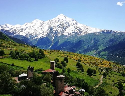
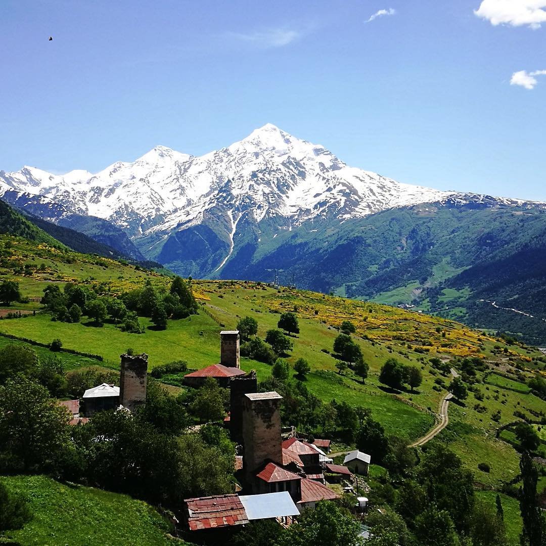
The trek begins in the center of Mestia and gradually climbs through forests and open pastureland. Via the Chkhuti ridge, the route gains elevation before descending into the Mulkhura valley. The first hours are the least dramatic part of the whole route: dirt roads, scattered small settlements and occasionally a cow standing in the middle of the path. But the reward comes as you gain height. To the west, Mount Ushba appears with its distinctive twin-summit shape. At 4,710 meters, it is sometimes called the Matterhorn of the Caucasus, and the comparison fits well: steep, beautiful and impressive.
In the late afternoon, the trail descends to Zhabeshi, a cluster of stone houses and towers spread across the valley floor. Dinner is served at the guesthouse: thick bread, salty cheese, soup and more food than you can finish. After six hours of walking, falling asleep comes easily.
Good to know: The first day is long, but not especially steep. It mainly serves as a warm-up stage. Save your energy — the more demanding days are still ahead.
Day 2 — From Zhabeshi to Adishi
| Distance | ~12 km |
| Elevation change | +800 m / −500 m |
| Walking time | 5–6 hours |
| Overnight | Guesthouse in Adishi |
The distance is shorter, but the views are much more impressive. The trail climbs from Zhabeshi toward the Tetnuldi ski area. The infrastructure looks a little industrial against the meadows, but you pass it quickly. Above the ski area, the landscape opens up: wide alpine pastures, scattered wildflowers and the snow-covered mass of Mount Tetnuldi, 4,858 meters high, filling the northern horizon.
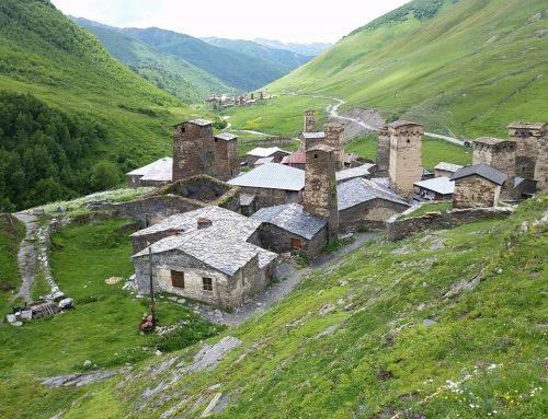
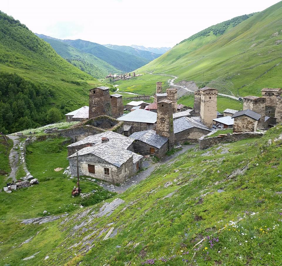
The descent into the Adishi valley is the highlight of the day. The trail passes through mixed forest and crosses several streams until Adishi becomes visible below: a tiny village, little more than a few towers and houses, set inside a natural amphitheater above which the Adishi Glacier slides slowly down the mountain. There is something special about this village: its remoteness, the scale of the surrounding mountains and the fact that it is still inhabited all stay in the memory.
Dinner at the guesthouse. Go to sleep early. Tomorrow is the big day.
Good to know: If the weather allows, take a short walk above the village after dinner. The evening light on the glacier is something no photo can truly capture.
Day 3 — From Adishi to Iprali via Chkhunderi Pass
| Distance | ~19 km |
| Elevation change | +850 m / −950 m |
| Walking time | 7–8 hours |
| Overnight | Guesthouse in Iprali |
This is the day everyone talks about. It begins with the crossing of the Adishi River, a glacial stream whose reputation is more dramatic than the reality on most summer days. Under normal summer conditions, the water reaches the knee or thigh, and it can be crossed carefully with trekking poles and steady steps. If the water level is higher — at the beginning of the season or after heavy rain — locals bring horses and help with the crossing for a small fee. The guide checks the conditions and chooses the safest option. In any case, it only takes a few minutes, and your feet will be cold. This is the adventure part of the day.
After the river crossing, the trail climbs steadily to Chkhunderi Pass, at around 2,740 meters. The ascent is sustained, but not too steep: you walk through open terrain, with the Adishi Glacier left behind and the Greater Caucasus range opening powerfully in front of you. At the pass itself, everything seems to stand still for a moment. Shkhara to the east, Tetnuldi to the north, glaciers flowing down from the peaks in every direction. If the weather cooperates, this is the most impressive viewpoint of the entire route.
The descent is long: through meadows, past the abandoned settlement of Khalde and down to Iprali, which sits on a slope above the river. You will be tired. On a day like this, dinner tastes especially good.
Good to know: Start early. The river crossing is safest in the morning, before glacial meltwater raises the water level. Your guide will set the departure time.
Day 4 — From Iprali to Ushguli
| Distance | ~11 km |
| Elevation change | +400 m / −350 m |
| Walking time | 4–5 hours |
| Overnight | Mestia |
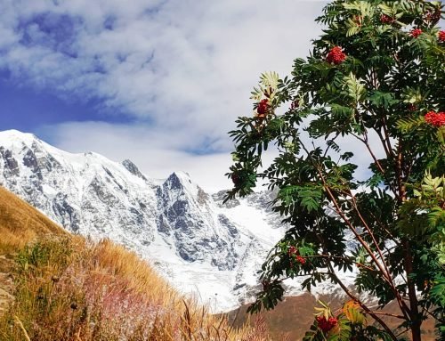
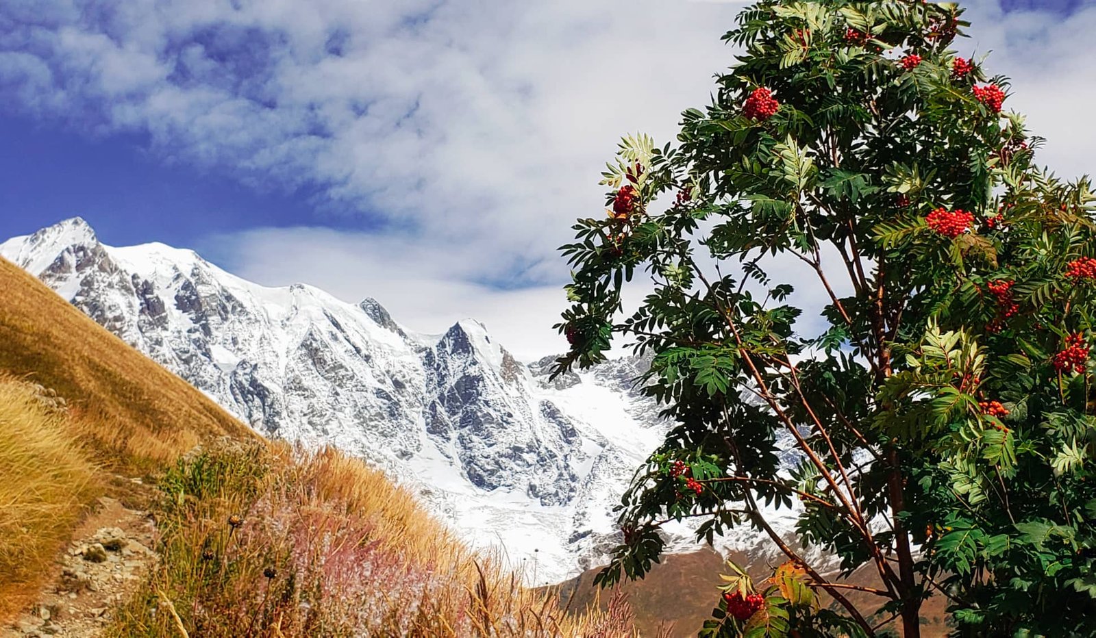
The final day is the gentlest: a reward after the effort of the previous day. The trail follows the upper Enguri valley upstream, through rolling highland pastures, while Shkhara grows larger in front of you. Georgia’s highest mountain is anything but modest. Its glacier, one of the largest in the Caucasus, fills the end of the valley like a frozen river that decided to stay.
And then Ushguli appears. It is not one village, but four: Murkmeli, Chvibiani, Chazhashi and Zhibiani, located at an altitude of 2,200 meters. Stone towers, some slightly leaning after centuries of gravity and weather. Cattle walking along stone paths. Lamaria Church on the hill, overlooking Shkhara.
You will have time to explore Ushguli before the transfer back to Mestia, which takes around 2.5–3 hours by vehicle. If you still have energy, it is worth walking toward the Shkhara Glacier for a few extra hours.
ROUTE / MAP
Tour price details
Before you book
Fitness level
Moderate. You should be comfortable walking several hours per day on mountain trails.
Weather
Mountain weather can change quickly. Warm and waterproof clothing is recommended.
Accommodation
Guesthouses are authentic and simple. Private bathrooms may be limited.
Best time
Usually from June to October, depending on snow and trail conditions.
PLAN YOUR SVANETI TREK
Send us your travel dates
We will check availability, recommend the best route format and explain what is realistic for your dates, group size and comfort expectations.
+995 577 748 793
tours@svanetitrekking.com
